Graduate Certificate in Geographical Information Systems
The Graduate Certificate in Geographical Information Systems (GIS) provides an introduction to the theory and application of GIS and remote sensing and is intended for students with an undergraduate degree that is not related to studies in GIS.
It provides a theoretical and practical framework for students from a range of graduate backgrounds, as well as those from the public sector and non-government organisations wishing to extend their choice of career path by acquiring knowledge and skills in the capture, synthesis and communication of spatially-referenced information.
It provides both a stand-alone program for the purposes of mid-career development, as well as an entry point into more advanced studies in the Graduate Diploma in Geographical Information Systems. Students will learn skills which are applicable to a range of areas such as urban and regional planning, infrastructure management, transportation, the environment, biological sciences, biodiversity management and archaeology.
Campus Information
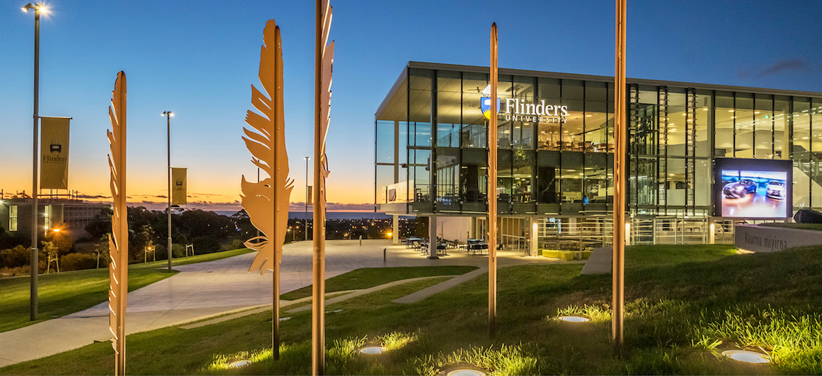
Bedford Park
Located just 12km south of the centre of Adelaide, the Bedford Park campus is Flinders' main campus. It's a spacious, elevated site with panoramic views to the coast and over the city. Our Student Hub offers 24/7 study spaces and access to all student services in one convenient location.
Intakes
- March
- July
Application Processing Time in Days: 10
Application Process
Minimum English Language Requirements
| English Level Description | IELTS (1.0 -9.0) | TOEFL IBT (0-120) | TOEFL CBT (0-300) | PTE (10-90) | |
|---|---|---|---|---|---|
| Expert | 9 | 120 | 297-300 | 86-90 | |
| Very Good | 8.5 | 115-119 | 280-293 | 83-86 | |
| Very Good | 8 | 110-114 | 270-280 | 79-83 | |
| Good | 7.5 | 102-109 | 253-267 | 73-79 | |
| Good | 7 | 94-101 | 240-253 | 65-73 | |
| Competent | 6.5 | 79-93 | 213-233 | 58-65 | |
| Competent | 6 | 60-78 | 170-210 | 50-58 | |
| Modest | 5.5 | 46-59 | 133-210 | 43-50 | |
| Modest | 5 | 35-45 | 107-133 | 36-43 | |
| Limited | 4 | 32-34 | 97-103 | 30-36 | |
| Extremely Limited | < 4 | < 31 | < 93 | < 30 |
Job Opportunity Potential
Your career
The use of geospatial information science technologies is rapidly increasing. GIS technologies are now commonly used in industries such as agriculture, forestry, mining, environmental management, biodiversity conservation, archaeology, health, and the social sciences. Consequently, employers in these areas are now requiring their staff to have more skills in GIS.
Potential occupations include:
- geographic analyst
- GISc data coordinator
- GISc technician
- geospatial specialist
- mapping technology officer
- natural resource information officer
- remote sensing officer
- research officer
- spatial ecologist
- spatial scientist.
Potential employers include:
- government departments
- regional development centers
- agriculture and horticultural centers
- not-for-profit agencies
- private companies that supply or collect spatial information.
PSW Opportunity
PG Diploma and Certificate courses are a pathway to the Master's Degree and can get up to 3 years of PSW visa after completing Masters.
Admission Requirement / Eligibility Criteria
Applicants must normally hold a bachelor degree or equivalent qualification. Applicants who have completed the Bachelor of Applied Geographical Information Systems from Flinders University or equivalent qualification are not eligible to apply for this graduate certificate.
- Course Code: 064259K
- Course Type: Full Time
- Course Level: Post Graduate Diploma or Certificate
- Duration: 06 Month
-
Total Tuition Fee:
17800 AUD
Annual Cost of Living: 24505 AUD
Application Fee: 70 AUD
Similar Programs
- Graduate Diploma in Archaeology and Heritage Management at Flinders University
- Graduate Certificate in Archaeology at Flinders University
- Graduate Diploma in Theological Studies at Flinders University
- Graduate Certificate in Theological Studies at Flinders University
- Graduate Certificate in Public Policy at Flinders University
- Graduate Diploma in International Relations at Flinders University